1883 Fort Scott, Topeka and Lincoln
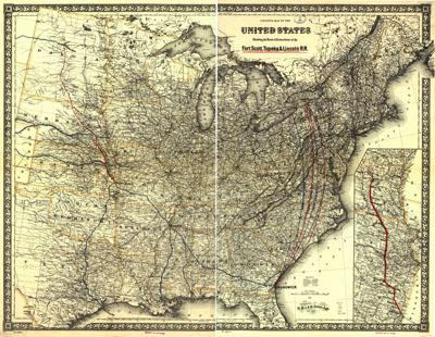
Colton's map of the United States showing the route & connections of the Fort Scott, Topeka & Lincoln R.R. G.W. & C.B. Colton & Co. New York, 1883. Map of the eastern half of the United States showing relief by hachures, drainage, railroads with emphasis on the main line.
SKU: trans065
Price Starting At: $12.50