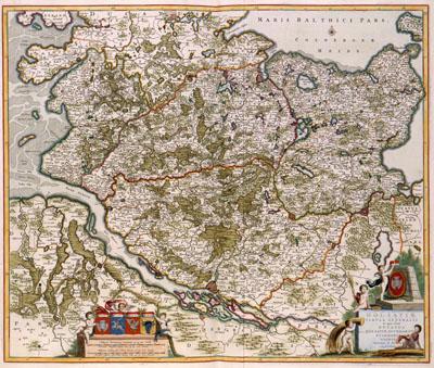
1688 Schleswig-Holstein, Denmark

HOLSATIAE | TABULA GENERALIS | in qua sunt | DUCATUS | HOLSATIAE, DITHMASIAE | STORMARIAE et | WAGRIAE, Frederik de Wit (1688) The Danish mathematician Johannes Mejer (1606-1674) had been working from 1638 on a composition of a map of Schleswig-Holstein, at that time mostly on Danish territory. The results of that work - an atlas with 43 detailed maps about Schleswig-Holstein - was published in 1652 by Caspar Dankwerth. Because the topographical survey of Schleswig-Holstein was one of the best of its time, Joan Blaeu (1598-1673) used these important maps in his Atlas Maior in 1662. Years later the maps were still very popular. This version of the map of Schleswig-Holstein was produced by Frederik de Wit (1630-1706).
SKU: 17thcentury292
Price Starting At: $12.50