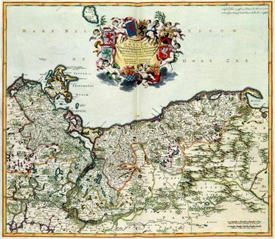
1688 Pomerania, Prussia

DUCATUS | POMERANIAE | Tabula Generalis, in qua sunt | DUCATUS POMERANIAE, STETTINENSIS | CASSUBIAE, VANDALIAE et BARDENSIS, | PRINCIPATUS RUGIAE ac INSULAE, | COMITATUS GUSKOVIENSIS, | et | DOMINIA LOUWENBURGENSE | WOLFGASTENSE et BUTOVIENSE, Frederik de Wit (1688) Pommern was part of the Prussian monarchy at the Baltic. This map, published by Frederik de Wit (1630-1706) was based on the first topographical survey of Pommern under supervision of the cartographer Eilhard Lubin (1565-1621). This resulted in a wall map of Pommern in 12 sheets, which determined the image of Pommern for more than 150 years.
SKU: 17thcentury080
Price Starting At: $12.50