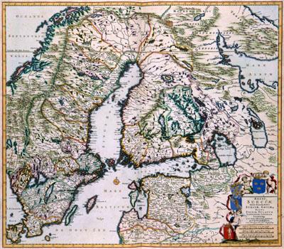
1688 Finland, Lappland, and Sweden

REGNI | SUECIAE | Tabula Generalis, divisa in | SUECIAE, GOTIAE .. | REGNA | FINNIAE, DUCATUM | LAPPONIAM, LIVONIAM | INGRIAMQ: | et in omnes subiacentes provincias, Frederik de Wit (1688) This map of the kingdom of Sweden with Finland and Lappland was published by Frederik de Wit (1630-1706). De Wit probable based his map on the work by his colleague Joan Blaeu (1598-1673) who published reliable maps about Scandinavia in his Atlas Maior in 1662. Blaeu for his part used maps from the scientist Anders Bureus (1571-1661), who was the head of the Swedish topographical survey
SKU: 17thcentury180
Price Starting At: $12.50