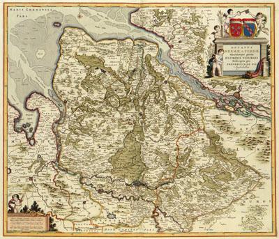
1688 Bremen and Verden, Germany

DUCATUS | BREMAE & FERDAE | Maximaeque partis | FLUMINIS VISURGIS, Frederik de Wit (1688) This map by Frederik de Wit (1630-1706) is based on a map published by Joan Blaeu (1598-1673) in his Atlas Maior in 1662. Blaeu's map for his part was based on the work by two Swedish cartographers: Johannes Gorries and Joannes Christoph. The Swedish involvement explains itself in that the largest part of the arch diocese Bremen and the diocese Verden were Swedish territory since the Treaty of Westfalen (1648).
SKU: 17thcentury082
Price Starting At: $12.50