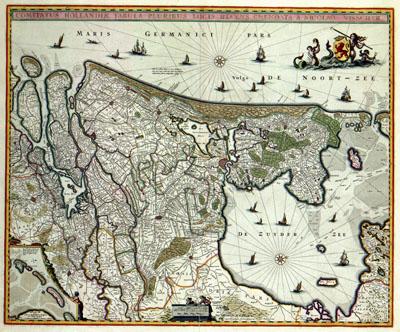
1682 Holland, Netherlands

Holland Netherlands. 1682. The first edition of this map of the province of Holland was originally published by Claes Jansz. Visscher (1587-1652) in 1652. After 1652 several editions of this map appeared including the map shown here. The wall map by Balthasar Florisz. van Berckenrode (1591/1592-1644) from 1651 was used as source for this map. Title: COMITATUS HOLLANDIAE TABULA PLURIBUS LOCIS RECENS EMENDATA A NICOLAO VISSCHER
SKU: 17thcentury108
Price Starting At: $12.50