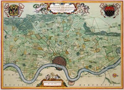
1681 Cologne, Germany

DESCRIPTIO AGRI | CIVITATIS COLONIENSIS, | Cum suis limitibus, terminis, viis, confiniis, interjacen= | tibus et adjacentibus Pagis, Villis, Castris etc., Nicolaas Visscher (1681) Nicolaas Visscher II (1649-1702) was given privileges from the States General in 1682 for publishing maps. Ever since he mentioned this fact on all of his maps. Therefore, this map must have been published after 1681. Depicted is the archdiocese of the electorate Cologne. Visscher based his map on a much earlier example published in 1635 by Willem Jansz. (1571-1638) and Joan Blaeu (1598-1673).
SKU: 17thcentury295
Price Starting At: $12.50