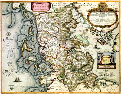
1662 Schleswig and Holstein, Denmark

DUCATVS | SIESWICVM | sive | IVTIA AVSTRALIS, John Blaeu (1662)The mathematician Johannes Mejer (1606-1674) prepared, ordered by the king of Denmark, between 1638 and 1648 a map of Schleswig and Holstein, at the time Danish territory. The results of this survey - an atlas with 40 detailed maps, engraved by the goldsmiths Matthias and Nicolaus Petersen - was published in 1652 by Caspar Dankwerth (c. 1615-1672). Via Dankwerth Joan Blaeu (1598-1673) could purchase the copper plates of this atlas. He used 34 of the copper plates for his world atlas, the Atlas Maior (1662).
SKU: 17thcentury280
Price Starting At: $12.50