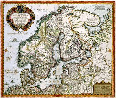
1656 Sweden, Norway, Denmark

Tabula exactissima Regnorum | SUECIAE et NORVEGIAE | nec non | MARIS UNIVERSI ORIENTALIS, Terrarumq: adjacentium summo studio ab, Andrea Bureo Sueco ; Abraham Goos sculpsit (1656)Unlike Norway that was part of the kingdom of Denmark until 1814, Sweden was an independent state from 1523 onwards. This map was composed by the surveyor and mathematician Anders Bureus (1571-1661). Between 1611 and 1626 Bureus produced several large maps of Sweden. In 1626 he prepared a large wall map of the complete territory of Scandinavia in six sheets. In 1656 the Amsterdam engraver Abraham Goos (deceased c. 1643) composed this map using the wall map. Claes Jansz. Visscher (1587-1652) published the map.
SKU: 17thcentury071
Price Starting At: $12.50