1879 Chicago, Rock Island, and Pacific
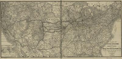
New rail road map of the United States and the Dominion of Canada, showing the Chicago, Rock Island and Pacific R.R.; the great overland route and short line to the west and south-west. Heubach, Emil. [Chicago, 1879] Inset: Map of the World. Map of the United States showing relief by hachures, drainage, cities and towns, state boundaries, and the railroad network with emphasis on the main line. The line was created by an act of the state of Illinois, February 27, 1847, and amended July 27, 1851. The line reached the Mississippi River on February 22, 1854, where the first bridge to cross the river was opened on September 1, 1854, linking Rock Island, Ill., with Davenport, Iowa.
SKU: trans061
Price Starting At: $12.50