1873 Bridgman's Reverisble Side 2
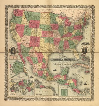
Bridgman's new reversible railroad distance and township map of Ohio and United States compiled from the most authentic sources. Bridgman, E. C. New York, 1873. Includes a railroad directory. On verso: "Railroad map of the United States with its territories . . ." c1872. Colored. Scale 1:6,000,000. Detailed map of Ohio including drainage, relief by hachures, cities and towns, and the railroad network with named lines. (second side)
SKU: trans045
Price Starting At: $12.50