1873 Atlantic and Pacific Railroad
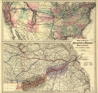
Maps showing the Atlantic & Pacific Railroad and leased lines. G.W. & C.B. Colton & Co.New York, 1873. Special map shows the main line and land grant in Missouri and includes iron and lead regions; general map covers United States showing the railroad network with the main lines distinguished by color; created by Act of Congress, July 27, 1866, with a land grant of 42 million acres; entry 329 shows extent of land grant in Arizona and New Mexico
SKU: trans052
Price Starting At: $12.50