1872 Louisville, New Albany, St. Louis
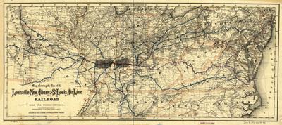
Map showing the line of the Louisville, New Albany, and St. Louis Air Line Railroad and its connections. G.W. & C.B. Colton & Co. New York, 1872. Map of the middle Atlantic and central United States showing drainage, cities and towns, state and county boundaries, and the railroad network with emphasis on the main lines. Indicates coal field in Illinois and Indiana.
SKU: trans072
Price Starting At: $12.50