1867 Toledo, Peoria, Warsaw
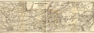
Map showing the Toledo, Peoria, & Warsaw Railway and its connections, 1867. G.W. & C.B. Colton & Co. New York, 1867. Map of the Midwest showing drainage, cities and towns, township and county boundaries, and the railroads with emphasis on the main line.
SKU: trans013
Price Starting At: $12.50