1861 Goldthwait's Map of the U.S.
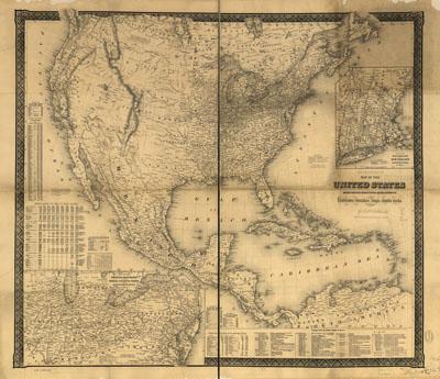
Goldthwait's map of the United States, British Provinces, Mexico, Central America, W. India Is. &c., exhibiting the railroads with their distances, single and double tracks and width of gauge. Goldthwait, J. H. New York, 1861. Population figures appear to the left and bottom of the map. "Principal forts and military stations in the U.S." are listed at the lower right of the map. Insets: Map of the railroads of New England and eastern N. York. --Map of the great railroad routes from the middle Atlantic ports to the Mississippi River. Shows drainage, relief by hachures, place names, and state boundaries.
SKU: trans079
Price Starting At: $12.50