1860 Southern States Railways
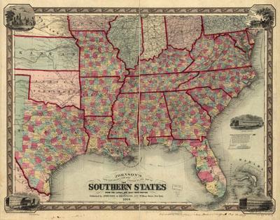
Johnson's new railroad & county copper plate map of the southern states from the latest and best information. Johnson & Browning. [n.p.], 1860, c1859. Includes views of the Smithsonian Institute, Mount Vernon, Patent Office, the General Post Office, and the Treasury Department Buildings. Detailed map showing drainage, state and county boundaries, place names, steamboat routes, and railroad network.
SKU: trans010
Price Starting At: $12.50