1857 United States and Canada
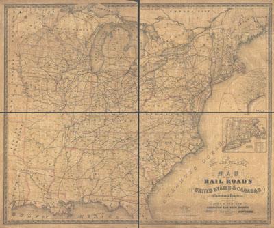
A new and complete county map of all the rail roads in the United States & Canadas in operation & progress. Schultz, John H., publisher. [New York, 1857] Insets: Texas. Massachusetts, Connecticut, and Rhode Island. Covers the eastern half of the United States. Shows drainage, county boundaries, and place names.
SKU: trans026
Price Starting At: $12.50