1840 Canals and Railroads of U.S.
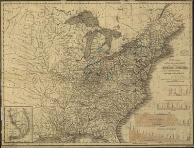
Map of the canals & rail roads of the United States, reduced from the large map of the U.S.; engraved by J. Knight. Tanner, Henry Schenck, 1786-1858. New York, 1840, c1830. Includes cross sections of 4 canals. Inset: South part of Florida. 10 x 8 cm. General map of the eastern United States showing drainage, state boundaries, and place names. Railroads are annotated in brown, canals in blue.
SKU: trans043
Price Starting At: $12.50