1830 United States Canals and Railroads
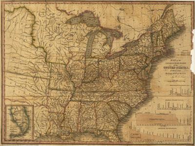
Map of the canals & rail roads of the United States reduced from the large map of the U.S. by Henry Schenck Tanner, 1786-1858. [Philadelphia] Engraved by J. Knight, 1830. From the author's A brief description of the canals and railroads of the United States. Includes cross sections of 4 canals and inset "South part of Florida." One of the earliest general maps of the eastern United States showing railroads in operation. The working lines are in blue, proposed lines are in green. Canals are shown in red and yellow.
SKU: trans016
Price Starting At: $12.50