1640 Virginia, North America
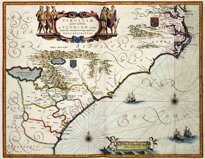
VIRGINIAE | partis australis, | et FLORIDAE partes, Joan Blaeu (1640)This map was published around 1640 by Joan Blaeu (1598-1673). The map was important for its accurate representation of the coast and its many geographical names. Blaeu based this map on a map by Hessel Gerritsz. (1580/81-1632) from 1631 and the results of several discoveries in the area
SKU: 17thcentury130
Price Starting At: $12.50