1640 Ischia, Italy
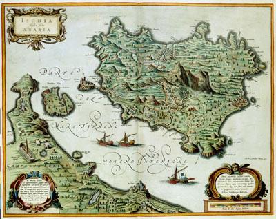
ISCHIA | Isola , olim | AENARIA, Joan and Cornelis Blaeu (1640)The map of the Italian island Ischia, near the coast of Napels, was published in 1640 by Joan (1598-1673) and Cornelis Blaeu (1610-1642) in the third volume of the `Atlas Novus'. Blaeu copied the map after an example from the map book `Italia' by the Italian cartographer Giovanni Antonio Magini (1555-1617). Julius Jasolinus who is mentioned in the text, wrote the explanatory text.
SKU: 17thcentury265
Price Starting At: $12.50