1638 India
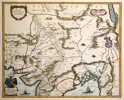
MAGNI | MOGOLIS | IMPERIVM, Joan and Cornelis Blaeu (1638)The map was published in 1638 by Joan (1598-1673) and Cornelis Blaeu (1610-1642). The map shows part of the current state of India. In the 17th century, very little was known about this country except for its shoreline. The map makes this clear: in the west two large lakes can be seen which are pure fantasy.
SKU: 17thcentury045
Price Starting At: $12.50