1635 Silesia, Poland, Germany
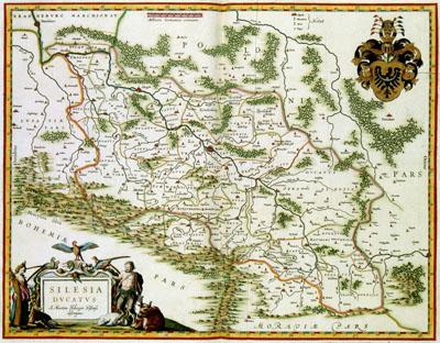
SILESIA | DVCATVS, Willem Jansz. Blaeu (1635) This map of Silezia was published in 1635 by Willem Jansz. Blaeu (1571-1638) in his Atlas Novus. Blaeu based the map on the 75-year old example of the German cartographer Martin Helweg (1516-1574). This map was also used by other Dutch cartographers such as Abraham Ortelius (1527-1598), Gerard de Jode (1509-1591) and Johannes Jansonius (1588-1664).
SKU: 17thcentury187
Price Starting At: $12.50